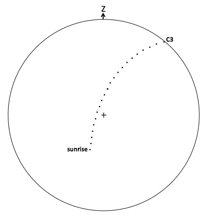
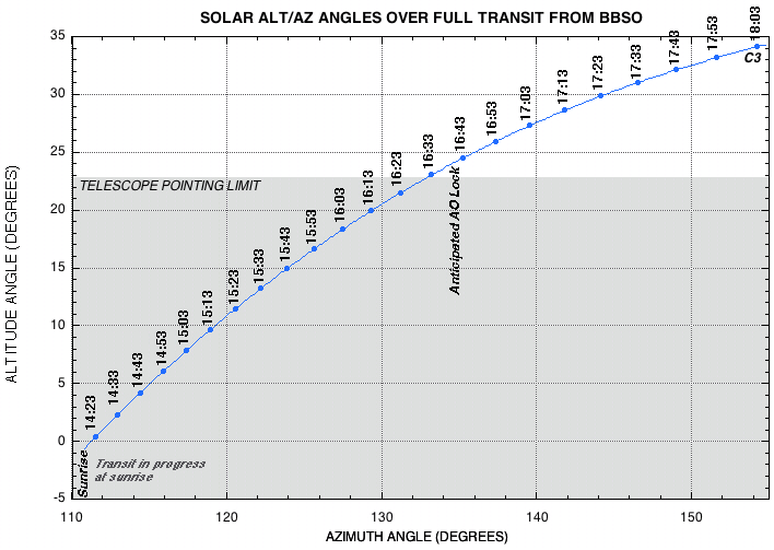
Sight Lines from 111° to 115°
in azimuth as the Sun rises from 0° to 5° in altitude angle
with Mercury in transit.
Terrain along these site lines extends only a few degrees above the
horizon.

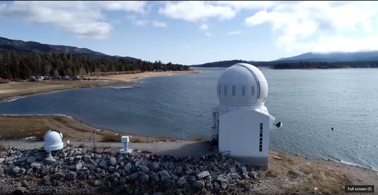
In the photo below, the top of the observatory dome is along a
sight-line of azimuth ~ 112 deg.
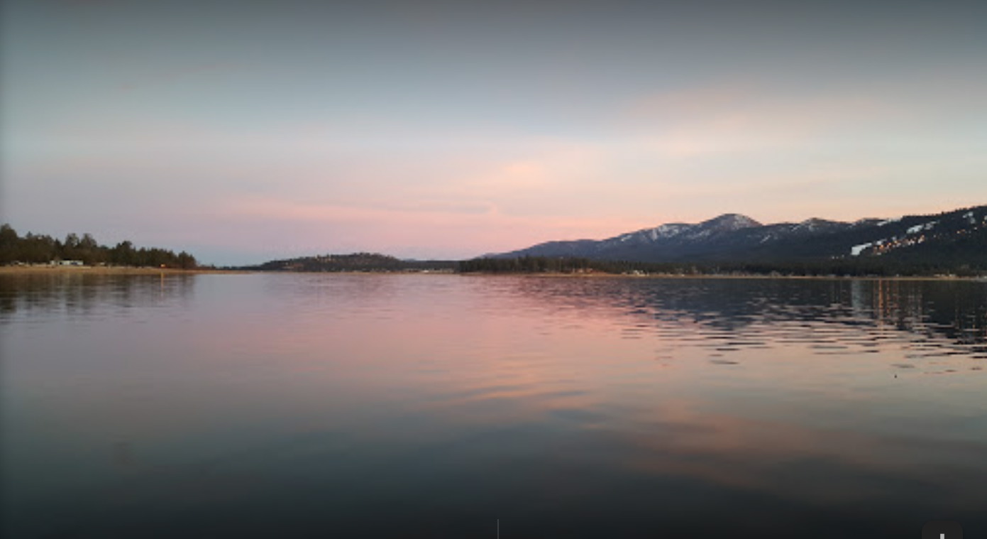
A photo in morning twilight, from the level of the lake, showing
(shifted a bit to the left) the same sight-line.
See this
DRONE VIDEO at
1:01 - 1:03.
A possible alternative sunrise venue is at Windy Point that is a short
distance west of BBSO on the lake's north shore. There the LOS
to obscuring terrain on the south side of the lake above horizon is
more distant. HOWEVER, Google Earth indicates higher elevation
terrain along these site lines may extend to higher altitude
angles at the same sunrise azimuths. This is best investigated in
situ.