10, 800 ft AMSL Over
Northern Kenya
35° 39.06'E, 03° 29.91'N
UTC Mid-Eclipse = 14h 25m 05s ± 0.6s
Duration of Totality = 10.7s ± 0.1s
Glenn Schneider
Steward Observatory and the Department of Astronomy, The University of Arizona
All underlined text on this page, are links to other pages or images
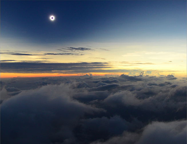
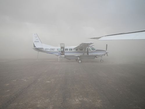
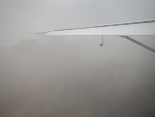
To begin, in media res, here (below) in part is what we saw.
(click on image to see at 2x size)
35° 39.06'E, 03° 29.91'N
UTC Mid-Eclipse = 14h 25m 05s ± 0.6s
Duration of Totality = 10.7s ± 0.1s
Glenn Schneider
Steward Observatory and the Department of Astronomy, The University of Arizona
All underlined text on this page, are links to other pages or images
Preamble and heart-felt
acknowledgments: First and foremost, I would like to very
sincerely and publicly thank my colleagues, friends, traveling
companions and (most important) fellow umbraphiles who ventured with me
to "the middle of nowhere" to dip into the Moon's umbral shadow for an
instant of time that will last forever. For their support and the
unwavering (but humbling) confidence they vested in me to get us to
the that fleetingly transitory ephemeral spot in space and time that
allowed us to share this most incredible and unforgettable experience,
I
am in their debt for untold Saros's yet to come. Along with
myself,
that baker's dozen that fought their through the E-40 minute haboob and
into the skies skimming the cloudtops to capture coronal photons from
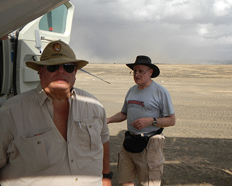
on-high were, in Aircraft #1: Joel Moskowitz, Craig Small, Rowland
Burley, Jay Friedland, Benno Kolland, Catalin Beldia, and in Aircraft
#2, Steve Kolodny, Charles Cooper, Dan McGlaun, Rick Brown and
Bob
Pine. THANKS GUYS! And thanks too to T.A.D. Watts of
Boskovick Air Charters, Ltd. (Kenya) not only for his superb piloting
skills in executing our in situ
dynamically evolving plan, but for his, and his company's,
professionalism (and toleration) in dealing with all of our details of
specificity w.r.t. our charter and implementation requirements. (I
wonder of how many of his clients usually worry about being one second
late?)
To begin, in media res, here (below) in part is what we saw.
(click on image to see at 2x size)

(photo by
Catalin Beldea). As to how we got there...
N.B.: Please SEE HERE for detailed background information on this eclipse, in the context of the phenomenology of low solar-elevation annular-total eclipses, but also with respect to our pre-eclipse planning in preparation for this event, that I won't repeat below.
The annular/total (aka "hybrid") central solar eclipse of 03 November 2013, provided an infrequent (some would say "rare") opportunity, by positioning oneself appropriately within the path of the moon's umbral shadow, to simultaneously witness a true totality with a complete chromospheric ring un-punctuated by Baily's beads (in contrast to the remarkable, but incomplete, chromospheric ring seen with the Oct 3, 1986 event). This, in principle, could be realized from near either "end" of the eclipse path within their respective narrowing zones of true totality.
On the western end, however, a chromospheric-ring eclipse would be visible only over water (in the Atlantic Ocean south of Bermuda) and would require observations from a ship or high-altitude jet aircraft to fly over prevalent clouds. The latter, at very high-risk with very tight navigation margins, while flying across (rather than along) the very narrow path of totality. This challenge was undertaken by a group of thirteen (plus pilot), using a Falcon 900 aircraft launched from Bermuda, and navigated by Xavier Jubier, but was ever so slightly "out of the {error} box", so the photosphere was never completely occulted by the moon. See the remarkable accounting (with photographs) of this spectacular, though "off center", occurrence as reported by Xavier. With the visual manifestation of the as the residual slice of lunar limb broken photosphere, rotating through an ~ 90° ark shrinking to several beads as (elsewhere) the chromosphere, and circumscribing corona became briefly visible, before symmetrically broadening again.
One could have attempted the same, by air, from the eastern end of the path over Eastern equatorial Africa. There, however, the shadow traversed over terra firma with the enticing enabling of "boots on the {stable} ground" that found significant appeal - with a plan that would allow "by air" (only) as a contingency back-up against the possibility of low cloud threatening ground-based visibility. And so THAT game was afoot, by a different group of (also) thirteen die-hard umbraphiles to one of the most remote and desolate regions on the planet - Turkana region of northern Kenya. From Sibiloi National Park ("the cradle of mankind") ,on the eastern shore of Lake Turkana, totality could be seen for a full eleven seconds with reasonable expectations for the possibility of cooperative weather (though one is reminded of the guiding reality known to eclipse chasers that "climate is what you expect, but weather is what you get")!
For TSE 2013 I had planned a fully automated (computer controlled) imaging program using two film SLR cameras using UMBRAPHILE and one digital camera using SEM, together optimizing the 11 seconds of totality available to us, with a combination of lenses and imaging sensitivities to cover a large dynamic range in depth, and fields of view. The concept (as implemented in previous eclipses) was to obtain raw images sufficient to enable post processing to being out high-resolution spatial structure in the corona and chromosphere, as was successfully done with cooperative weather from this eclipse in Uganda (Druckmuller) and Gabon (Pasachoff). The set-up was more compact than I had used in 2012, 2006, 2002, or 2001, replacing my lug-a-scope eclipse camera (retired in its most recent incarnation after TSE2012 ... but will be back!) with more easily transportable QUESTAR. The "compactness" was dictated by the limited payload weight available to us in our transport/contingency eclipse chasing aircraft.
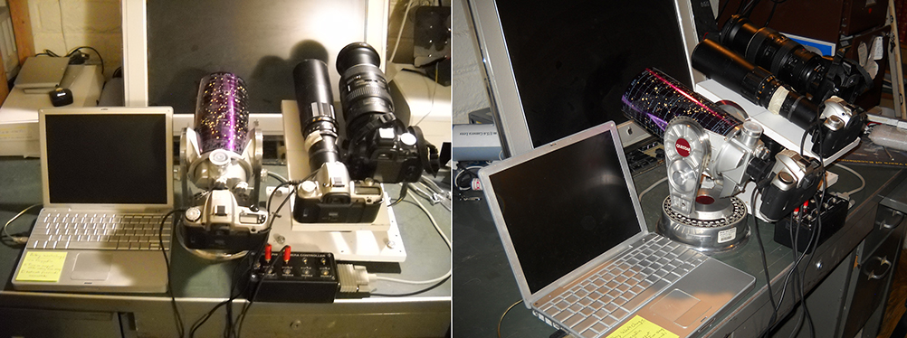
Imaging
equipment planned for TSE2013 - not to see the light of eclipsed-day
due to weather.
The overall plan for TSE 2013, after members of our group had gathered in the days prior in Nairobi, was to fly in two chartered Cessna Grand Caravan 208B aircraft from Willson airport (Nairobi) leaving about 7:15 AM EAT (East Africa Time), arriving at Sibiloi National Park (SNP) about 9:30 AM MST (totality bout 8 hours later at 5:25 PM EAT = 14:25 UTC) after a visually stunning flight over Kenya's central rift valley and volcanic region to the south of Lake Turkana itself. Eclipse day began, exactly to that plan. Though as "normally" configured a single 208B could carry up to a dozen passengers, here we split our load using two aircraft each with only 6 and 7 passengers so the same planes could then be used, if needed, to observe the eclipse from the air with ample viewing positions for all. As a high-wing aircraft (that would block the view toward the Sun), the windows in mid-cabin would not be useful for contingency eclipse observing. So we planned, as a back-up against our ground-based observing plans being thwarted by clouds, to use only the very front most and rear windows, and upper (open) hatch of the cargo bay door on the left side of the aircraft. Unneeded seats were removed to increase the aircraft endurance (range) should we need to "chase" by air to find a hole in the sky. And so we flew in tandem on our ~ 2-1/4 hour flight from the southern to the northern hemisphere from a major population center to the ultimate of all conceptual "boondocks" normally only very sparsely seeing visitors.
On the flight to SNP, in aircraft #1, Rowland Burley (747 pilot for Cathey Pacific airways who decades earlier had first learned to fly at Willson airport in Nairobi!) proudly showed us every rock, hill, ravine, and outcropping along the way remembered from his days as a student at the University in Nairobi studying the geology of the central rift. though motivated/enabled by the needs of the eclipse, of course, the aerial "flightseeing" of the Kenyan topography was quite spectacular and appreciated by all.
/DIGRESSION: At this juncture, I refer you to a most complete, detailed, and well written report of the events of the day, as told (with photos) by Dan McGlaun that captures to a "t" the events that had transpired. With that he (happily!) has pre-empted my need to redundantly convey that here, as he writes to our "adventure" together with alacrity and informative conveyance of detail that would be hard to match. So, GO NOW TO HIS WEB SITE and read what he has to say! Do it! And be sure to click all of his picture links. /END_DIGRESSION
Now that you have seen Dan's full account and photos, here are a few more "point and shoots" from aircraft #1 flight up to SNP. After staring over every inch of the terrain for years with "Google Earth" it was amazing to fly over it with such "familiarity"!
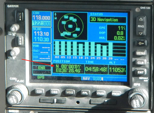 Crossing the Equator (aircraft GPS) |
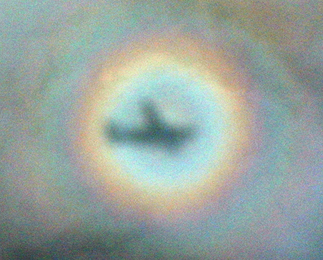 (Aircraft) "Glory" seen on some light clouds below |
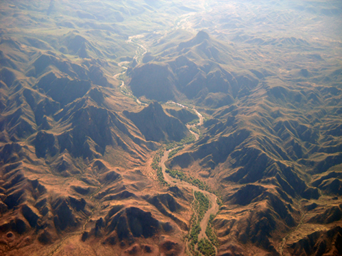 Meandering
River Meandering
River |
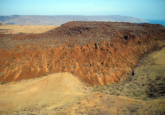
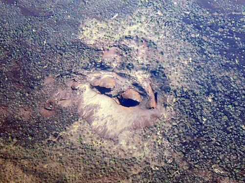 Double Volcanic Cone |
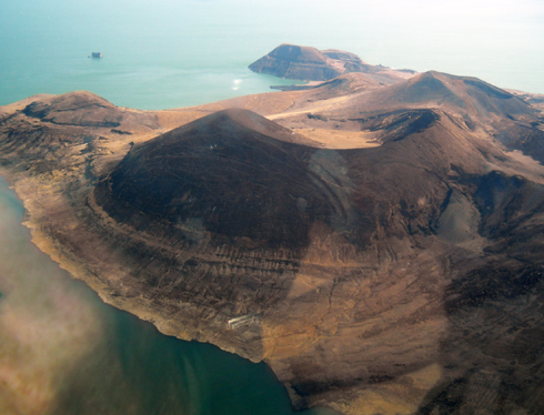
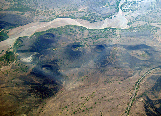 Multiple Volcanic Cones |
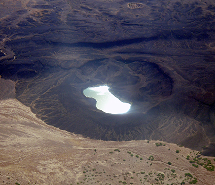 Crater Filled Lake |
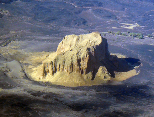 "Top Hat" Rock Outcropping |
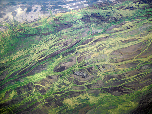 It's So Green! |
 Wow! |
 Approaching the "Barrier" |
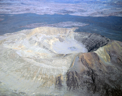
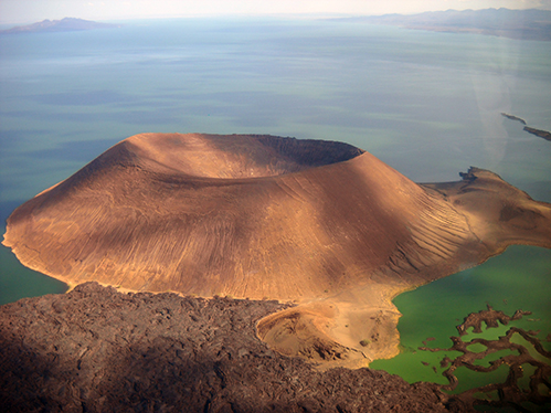 Lake Turkana South End Volcanic Cone |
 South Island (Lake Turkana) |
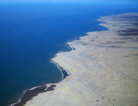 Eastern Shore Approaching SNP |
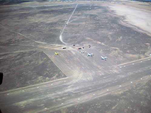 SNP Airstrip -- Eclipse Site |
On 04 November 2013, the day after the eclipse, I posted to the Solar Eclipse Mailing List (SEML) a timely (but not fully complete) summary of the eclipse-day events, and the situation that ultimately had forced us to abandon our plans for ground-based observations and take to the air. A "decision" that came easily, in the end, but with uncertainty that we could actually execute it until the moment we did. Here, almost verbatim is what I had said then. Those who subscribe to the SEML can skip over this part, but here if you have not yet do READ DAN'S ACCOUNTING of the day from his perspective and for pictures (click his links!) I was too pre-occupied at times to take myself!
NOV 4, 2013 via SEML:
"Apologies for any typos below, I am using
a highly internet-challended hotel router and typing is painful.
It is SO good to hear of so many successes across the path including
from places with expected "low odds", and so bitterly disappointing to
hear of some that had not worked out so well. For our group of
umbraphiles...
TSE 2013 -- A somewhat personal accounting...
First, congratulations to Xavier J. and his group in the skies south of Bermuda. Xavier and I have been inter-comparing notes, and details of flight planning for both ends of this eclipse path for some time. Our primary plan, at Sibiloi National Park (SNP) on the Eastern shore of Lake Turkana (formerly Lake Rudolph) in northern Kenya and been with hope to observe from the ground using our (two) Cessna Grand Caravan 208B aircraft for transport (only) to/from Nairobi. We chose those aircraft, in particular, to charter for several reasons, but paramount was the ability to use them if needed (and proved so!) to attempt to get above any "low" cloud (< appx 12, 500 ft) if threatening. A major plus of these aircraft was the ability to fully open a large upper hatch of a cargo door in the rear of the aircraft (left side) to give a windowless view of totality with a contingency EFLIGHT*.
All day long lowland broken cumulous clouds had been forming, consecutively building, breaking apart, dissipating, etc., cyclically dashing our hopes, and giving us confidence, for ground based success of changes.
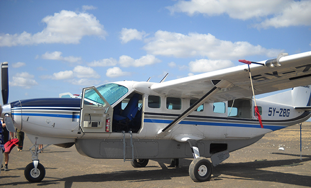
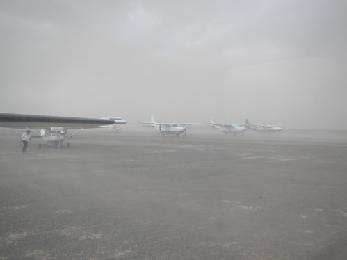
One of our two Cessna Grand Caravan 208B aircraft (with cargo pod), with the rear cargo door upper hatch open,
and "puffy" cumulous clouds typical of much of the early part of the day.
Vacillation to execute or not our "by air" option as described HERE was driving us crazy, though we knew we had until about 4:30 PM EAT for that "drop dead" decision.
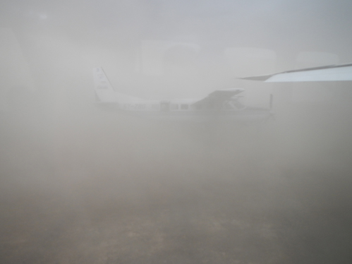
By appx 4 PM local time (totality was at 5:25 PM local time) a new twist was emerging with a dark solid wall of distant heavy cloud that seemed to be approaching toward lake Turkana from the south east. "Eyeballing" that to many in our group it looked like the darkness of a rain storm. Earlier in the day we had pre-loaded our baseline contingency flight plan (time-correlated lat/lon) into the lead (of the two identical Grand Caravan aircraft's) navigation system GPS's as our "get above the clouds option", but with this rapidly advancing encroachment, we felt it prudent to load a contingency plan including options (much) further to the west as those clouds looked possibly to top off higher than we could get, and to stay "ahead" of this.
As we (with the lead pilot, Tad Watts of Boscovic Air Charters, a GREAT company to work with) were doing this in the aircraft, about 50 minutes before totality the rest of the group was gathered outside one of the aircraft with an eye to the sky, and a prayer to the heavens -- when the wind started picking up (it had been quite gusty for some time) rather dramatically. We noted in the AIRCRAFT cockpit the wind had suddenly "swung around" at ground level by about 30-40 degrees. Looking out the front view screen of the aircraft, we could see the storm approaching - FAST - but it was not a rainstorm, but a sandstorm, that quickly had seem to come from nowhere. Ahead of us (in the direction we were parked) it was obvious it was about to envelop the group outside and the parked aircraft in less then a minute or so. The group had been looking to the west toward the Sun, and was not seeing the sandstorm barreling down on us. Tad leaned over to me from his (left hand) pilot seat pointing to the oncoming sandstorm almost upon us saying "get them in the aircrafts and close up" (perhaps with a few different words, but clear). I then yelled out my open door to the assembled group "get inside the airplanes NOW", that many interpreted as a pre-emptive decision at that point to fly for sure rather than for shelter against the storm. They did just as the opacity outside dropped to near zero with hugely strong winds (and none of us ever set foot out of either aircraft again until later that night back in Nairobi).
So dense was the blowing sand we could not see our "sister" aircraft as the brunt of it was howling by parked just tens of meters away. I am sure at the instant we all knew, for us, the eclipse at Turkana east would be lost, and feared a contingency flight grounded. We nonetheless decided to continue entering contingency EFLIGHT waypoints into the flight GPSs as the sandstorm was howling around us. By some miracle (divine intervention?) the worst of it passed in about twenty minutes, but leaving in its wake a column of churned dust extending over a mile in vertical extent (as Dan McGlaun later confirmed in situ as we were ascending). By about 4:50 PM the sky conditions for in situ eclipse viewing had turned dismal in expectation, but with visibility at the runway AOK to safely get off the ground. So we did. The effects of the sandstorm had escape made unequivocal for us. Feet on the ground -- for us -- was not to be the case for TSE 2013.
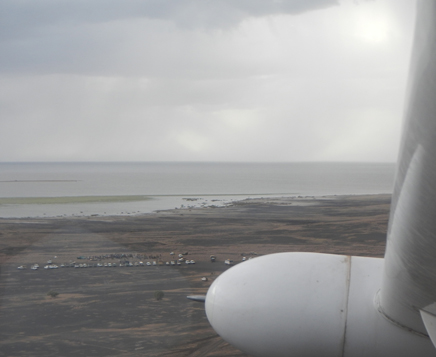
Our parting view of the Turkana lake shore facing toward the cloud-obscured eclipse,
with our hopes for those left on the ground as we actively sought to get above the muck.
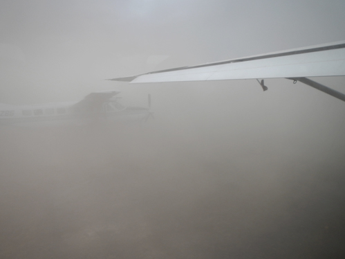
The plan laid in to get as far west as we could in the time remaining to try to get ahead of the sand storm and the clouds also associated with it. The initial set of optimistically laid in waypoints one by one proved too distant to reach with simultaneously needing to go off the planned track to circumvent the flight-level effects of the storm. For a time, over Lake Turkana the most amazing, dark, threatening, and unfriendly dust-laden storm clouds were frothing just outside our right side windows. Though we remained composed (or tried to), it admittedly was a bit frightening.

A mile high over Lake Turkana, the dust column and storm clouds were just a stones through out the right hand window. (Climb!, Climb!)
One by one we rejected our "by the plan" maneuvering points, but in the face of highly variable and uncertain winds fixed on an eclipse intercept point that looked potentially "doable" at 4:25:05 UTC on 10,000 ft centerline. Getting exactly (+/- a couple of km there at the requisite time +/- appx 6 seconds) was yet another story.
Computing "what to do" is actually not that difficult, though requires much attention to many issues of detail, hence codification through S/W like EFLIGHT (see: http://nicmosis.as.arizona.edu:8000/ECLIPSE_WEB/TSE2015/EFLIGHTSW_OVERVIEW_SCHNEIDER.pdf ; 20 Mby) is a huge help (and for myself, I would not consider such PLANNING without such a tool). However, execution can (and in this sort of situation) still IS very challenging and a tribute to piloting skills (of others) like Tad. This was VERY much the case for our flight(s). The nav system on the Caravan 208 B is not quite as "sophisticated" as the sort of Flight Management System/Command Data Units (FMS/CDUs) available on many commercial or corporate jet aircrafts, like the Falcon 900 B that (I think!) Xavier and company used. In our case we had planned an outbound ground speed (not air speed) track of 125 kts and to drop to 100kts as we later would exit the final turn onto the totality viewing track (with the Sun out the left side open cargo door hatch).
As it was, with variable winds "pushing" the aircraft up to (I think, need to confirm with Tad) 171 kts, {and right-now [Nov 4 writing] not sure how slow GROUND speed}, with also course heading (vs. course) adjustments making that intercept was quite "intense" an exercise. The "approach" we executed looked NOTHING like the plan and was, no-pun intended, "on the fly" (but maybe not quite "seat of the pants, but informed and highly constrained) with Tad at the controls and my with pre-printed tables (no laptop bouncing around while maneuvering), and navigating by my wristwatch and watching the NAV/GPS displays.
I don't know what my companions "in back" were thinking with the twists, turns, and speed changes we were executing (I assure them neither of us were drinking and flying!). Dan McGlaun recorded on his personal GPS the last part of our flight to totality that (now having seen it graphically) looks in part like a pretzel. In the end, rather than on the precise time hack, Tad just said to me over the flight headset "just tell me when to turn" (onto the final viewing track). I don't think I ever had my stomach in knots doing this sort of thing before, but this time was different knowing that a mere few seconds would make the differnce between unbridled success and abject failure.
Looking at my $12 Casio wristwatch (on UTC of course) and the est. ETA display to mid eclipse, at 94 seconds before C2, and taking a best guess at what the wind might do over the next minute I yelled "TURN NOW", and Tad did. This was intentionally 7 seconds later than the "baseline" plan having noted we were somewhat deviant from that in final closure due to the winds. Coming out of that appx 30 sec turn, I yelled again (to Tad) "slow down", as he simultaneously pointed ahead as we were heading then right into the top of a cumulous cloud. With just a "go up" (so we might then be slightly off centerline IF we were in the right place) yelled by me, as he already was beginning a climb, we goosed the plane up about another 300 ft to clear the cloud top before totality.
Our second, "sister" aircraft the whole time 'trailing' half a mile behind us following our every maneuver and in lock, step, executing the turn at the same time to fly a very slightly offset parallel track.
About a minute before the turn had started, in anticipation, I yelled to the back of the airplane "Open the Cargo Bay Door" (not then intentionally reminiscent of the scene with HAL in 2001 where things went went very wrong), as the six umbraphiles in the back of the airplane found their positions in the seat-less floor and did so. I disentangled from the right seat headset up front and dove for a windowed-seat behind the pilots seat, as I "knew" there would be insufficient time to get to the back of the plane. As I did, I realized that Tad had not started the combined slip/bank maneuver for the viewing run we had prior discussed, but understood immediately that the cross-wind situation in a climb with so much "off the plan" must have made that too marginal with all else going on and climbing. As a result (as known under that condition) the front of the wing obscured the view from that window.
I then quite literally dove across two seat back tops between that position and the behind-wing window just ahead of the cargo door, getting to that window about 10 seconds before the (glorious) C2 diamond ring. I watched the onset of totality (and all of its appx 11 seconds) while laid out across a couple of seat row tops through that (excellent quality) window while my companions had a fully "in the open" view normally seen only by parachute jumpers. In this situation (for me) it was not possible for me to execute my by-air photographic program. Having needd to have been in the right hand seat with our pilot right up to the the final minute before totality put that out of mind. I knew others on the aircraft would be doing so, and catching coronal photons on my retinas was the real reward sought.
Having stabilized my position laying out across the seat back and looking through the window, the sight was truly astounding. A brilliant pre-C2 diamond ring was shrinking and breaking up into a multitude of beads with an arc of extended chromosphere. The screams of joy and delight of my companions at that almost too-small moon, with the C2 contact point just where it "should have been" (i.e., so we were right on the mark, but some bit of luck I fully admit) drowned out the sound of wind rushing by out the opened upper door. I viewed just with eyeballs, so no high-resolution views of the dance of beads and chromosphere, but the visual appearance of the umbra enveloping the Sun in the sky and the darkened clouds as close as 300 feet below whisking by was one not to be forgotten.
ADDED: And THIS (at mid-eclipse) is what we saw ... though no photograph, no matter how expertly acquired (this one from Catalin Beldea) can begin to capture the beauty and majesty of what we were witnessing from 2 miles high with nothing but rarefied eye (and no clouds!) between us an the lunar-occulted Sun as we danced on the tapestry of the cloud tops just feet below our aircraft.
ADDED: AND (post-facto from on-board recorded position data) HERE (below) is how we got there - with a calculated reason for every twist and turn.
It was decidedly very different than 1986, and I suspect very similar to what Xavier, Dirk, Stephan, and Liz saw in Bermuda, but with us just above the dark cloud tops. It was unquestionably (as expected modulo prior uncertain position error) a TRUE total eclipse. I do not (yet) have an exact timing {see below as derived subsequently from images and recorded position data}, and hope to get so after an analysis of Dan's GPS's kmz file recording our actual flight path {done}, and Catalin's time-resolved images {determined later with higher accuracy and precision with Joel's iPhone recording!} . I can say that the 3rd contact diamond ring that blazed (all to quickly with heart-beating at ~ 150 per minute during that time) was by-eye exactly diametrically opposite C2, so an indication to me that we did hit the mark. But during totality and watching the chromospherically lit limbs all the lead-up of how we got to where we were was eschewed to minutia. The transition to/from totality and that fleeting glimpse of the pearly white corona over the thick dust-laiden clouds below our feet was astounding. I'll write more after returning to the U.S. on the details of the eclipse itself.
Here, in closing (for now), I promise my companions who will join me in our FLIGHT 2015 a bit less "exciting" ride, but I am sure an equally exciting and glorious eclipse. ...
Clear skies to all for 20 March 2015, now the NEXT one!
Cheers,
Glenn Schneider -- decompressing in Nairobi"
===================TSE 2013 -- A somewhat personal accounting...
First, congratulations to Xavier J. and his group in the skies south of Bermuda. Xavier and I have been inter-comparing notes, and details of flight planning for both ends of this eclipse path for some time. Our primary plan, at Sibiloi National Park (SNP) on the Eastern shore of Lake Turkana (formerly Lake Rudolph) in northern Kenya and been with hope to observe from the ground using our (two) Cessna Grand Caravan 208B aircraft for transport (only) to/from Nairobi. We chose those aircraft, in particular, to charter for several reasons, but paramount was the ability to use them if needed (and proved so!) to attempt to get above any "low" cloud (< appx 12, 500 ft) if threatening. A major plus of these aircraft was the ability to fully open a large upper hatch of a cargo door in the rear of the aircraft (left side) to give a windowless view of totality with a contingency EFLIGHT*.
All day long lowland broken cumulous clouds had been forming, consecutively building, breaking apart, dissipating, etc., cyclically dashing our hopes, and giving us confidence, for ground based success of changes.
One of our two Cessna Grand Caravan 208B aircraft (with cargo pod), with the rear cargo door upper hatch open,
and "puffy" cumulous clouds typical of much of the early part of the day.
Vacillation to execute or not our "by air" option as described HERE was driving us crazy, though we knew we had until about 4:30 PM EAT for that "drop dead" decision.
By appx 4 PM local time (totality was at 5:25 PM local time) a new twist was emerging with a dark solid wall of distant heavy cloud that seemed to be approaching toward lake Turkana from the south east. "Eyeballing" that to many in our group it looked like the darkness of a rain storm. Earlier in the day we had pre-loaded our baseline contingency flight plan (time-correlated lat/lon) into the lead (of the two identical Grand Caravan aircraft's) navigation system GPS's as our "get above the clouds option", but with this rapidly advancing encroachment, we felt it prudent to load a contingency plan including options (much) further to the west as those clouds looked possibly to top off higher than we could get, and to stay "ahead" of this.
As we (with the lead pilot, Tad Watts of Boscovic Air Charters, a GREAT company to work with) were doing this in the aircraft, about 50 minutes before totality the rest of the group was gathered outside one of the aircraft with an eye to the sky, and a prayer to the heavens -- when the wind started picking up (it had been quite gusty for some time) rather dramatically. We noted in the AIRCRAFT cockpit the wind had suddenly "swung around" at ground level by about 30-40 degrees. Looking out the front view screen of the aircraft, we could see the storm approaching - FAST - but it was not a rainstorm, but a sandstorm, that quickly had seem to come from nowhere. Ahead of us (in the direction we were parked) it was obvious it was about to envelop the group outside and the parked aircraft in less then a minute or so. The group had been looking to the west toward the Sun, and was not seeing the sandstorm barreling down on us. Tad leaned over to me from his (left hand) pilot seat pointing to the oncoming sandstorm almost upon us saying "get them in the aircrafts and close up" (perhaps with a few different words, but clear). I then yelled out my open door to the assembled group "get inside the airplanes NOW", that many interpreted as a pre-emptive decision at that point to fly for sure rather than for shelter against the storm. They did just as the opacity outside dropped to near zero with hugely strong winds (and none of us ever set foot out of either aircraft again until later that night back in Nairobi).
 Still bathed in eastern sunlight, the sandstorm approaches from the west |
 As the dust reaches aircraft #2, last man aboard... |
 Just ~ 10 meters away. Visibilty going... |
 ...going... |
 ...pretty much GONE! Appx E - 45 minutes! |
 And then it started to pass. Other AC parked nearby... |
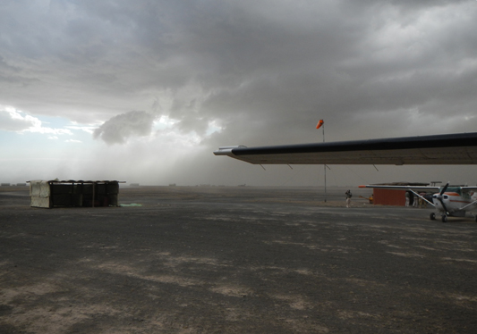 ...but, then looking ESE TOWARD the Sun... |
 As soon as it was safe... time to get out of Dodge! |
Photos
courtesy of Jay Friedland
So dense was the blowing sand we could not see our "sister" aircraft as the brunt of it was howling by parked just tens of meters away. I am sure at the instant we all knew, for us, the eclipse at Turkana east would be lost, and feared a contingency flight grounded. We nonetheless decided to continue entering contingency EFLIGHT waypoints into the flight GPSs as the sandstorm was howling around us. By some miracle (divine intervention?) the worst of it passed in about twenty minutes, but leaving in its wake a column of churned dust extending over a mile in vertical extent (as Dan McGlaun later confirmed in situ as we were ascending). By about 4:50 PM the sky conditions for in situ eclipse viewing had turned dismal in expectation, but with visibility at the runway AOK to safely get off the ground. So we did. The effects of the sandstorm had escape made unequivocal for us. Feet on the ground -- for us -- was not to be the case for TSE 2013.
Our parting view of the Turkana lake shore facing toward the cloud-obscured eclipse,
with our hopes for those left on the ground as we actively sought to get above the muck.
The plan laid in to get as far west as we could in the time remaining to try to get ahead of the sand storm and the clouds also associated with it. The initial set of optimistically laid in waypoints one by one proved too distant to reach with simultaneously needing to go off the planned track to circumvent the flight-level effects of the storm. For a time, over Lake Turkana the most amazing, dark, threatening, and unfriendly dust-laden storm clouds were frothing just outside our right side windows. Though we remained composed (or tried to), it admittedly was a bit frightening.
A mile high over Lake Turkana, the dust column and storm clouds were just a stones through out the right hand window. (Climb!, Climb!)
One by one we rejected our "by the plan" maneuvering points, but in the face of highly variable and uncertain winds fixed on an eclipse intercept point that looked potentially "doable" at 4:25:05 UTC on 10,000 ft centerline. Getting exactly (+/- a couple of km there at the requisite time +/- appx 6 seconds) was yet another story.
Computing "what to do" is actually not that difficult, though requires much attention to many issues of detail, hence codification through S/W like EFLIGHT (see: http://nicmosis.as.arizona.edu:8000/ECLIPSE_WEB/TSE2015/EFLIGHTSW_OVERVIEW_SCHNEIDER.pdf ; 20 Mby) is a huge help (and for myself, I would not consider such PLANNING without such a tool). However, execution can (and in this sort of situation) still IS very challenging and a tribute to piloting skills (of others) like Tad. This was VERY much the case for our flight(s). The nav system on the Caravan 208 B is not quite as "sophisticated" as the sort of Flight Management System/Command Data Units (FMS/CDUs) available on many commercial or corporate jet aircrafts, like the Falcon 900 B that (I think!) Xavier and company used. In our case we had planned an outbound ground speed (not air speed) track of 125 kts and to drop to 100kts as we later would exit the final turn onto the totality viewing track (with the Sun out the left side open cargo door hatch).
As it was, with variable winds "pushing" the aircraft up to (I think, need to confirm with Tad) 171 kts, {and right-now [Nov 4 writing] not sure how slow GROUND speed}, with also course heading (vs. course) adjustments making that intercept was quite "intense" an exercise. The "approach" we executed looked NOTHING like the plan and was, no-pun intended, "on the fly" (but maybe not quite "seat of the pants, but informed and highly constrained) with Tad at the controls and my with pre-printed tables (no laptop bouncing around while maneuvering), and navigating by my wristwatch and watching the NAV/GPS displays.
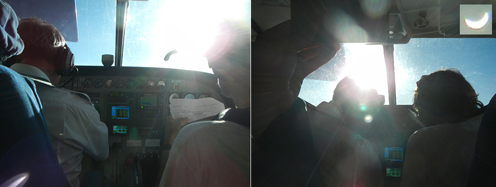
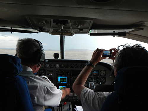
Tad (left
seat) piloting, and Glenn (right seat) navigating constantly confer,
and put the aircraft - temporarily - on an outbound heading toward the
Sun (in partial eclipse, see image inset) before additional maneuvering
for a later pin-point rendezvous with the Moon's umbral shadow.
Note at a climb-out altitude of (initially 10,000 ft) the CLEAR SKIES!
I don't know what my companions "in back" were thinking with the twists, turns, and speed changes we were executing (I assure them neither of us were drinking and flying!). Dan McGlaun recorded on his personal GPS the last part of our flight to totality that (now having seen it graphically) looks in part like a pretzel. In the end, rather than on the precise time hack, Tad just said to me over the flight headset "just tell me when to turn" (onto the final viewing track). I don't think I ever had my stomach in knots doing this sort of thing before, but this time was different knowing that a mere few seconds would make the differnce between unbridled success and abject failure.
Looking at my $12 Casio wristwatch (on UTC of course) and the est. ETA display to mid eclipse, at 94 seconds before C2, and taking a best guess at what the wind might do over the next minute I yelled "TURN NOW", and Tad did. This was intentionally 7 seconds later than the "baseline" plan having noted we were somewhat deviant from that in final closure due to the winds. Coming out of that appx 30 sec turn, I yelled again (to Tad) "slow down", as he simultaneously pointed ahead as we were heading then right into the top of a cumulous cloud. With just a "go up" (so we might then be slightly off centerline IF we were in the right place) yelled by me, as he already was beginning a climb, we goosed the plane up about another 300 ft to clear the cloud top before totality.
Our second, "sister" aircraft the whole time 'trailing' half a mile behind us following our every maneuver and in lock, step, executing the turn at the same time to fly a very slightly offset parallel track.
About a minute before the turn had started, in anticipation, I yelled to the back of the airplane "Open the Cargo Bay Door" (not then intentionally reminiscent of the scene with HAL in 2001 where things went went very wrong), as the six umbraphiles in the back of the airplane found their positions in the seat-less floor and did so. I disentangled from the right seat headset up front and dove for a windowed-seat behind the pilots seat, as I "knew" there would be insufficient time to get to the back of the plane. As I did, I realized that Tad had not started the combined slip/bank maneuver for the viewing run we had prior discussed, but understood immediately that the cross-wind situation in a climb with so much "off the plan" must have made that too marginal with all else going on and climbing. As a result (as known under that condition) the front of the wing obscured the view from that window.
I then quite literally dove across two seat back tops between that position and the behind-wing window just ahead of the cargo door, getting to that window about 10 seconds before the (glorious) C2 diamond ring. I watched the onset of totality (and all of its appx 11 seconds) while laid out across a couple of seat row tops through that (excellent quality) window while my companions had a fully "in the open" view normally seen only by parachute jumpers. In this situation (for me) it was not possible for me to execute my by-air photographic program. Having needd to have been in the right hand seat with our pilot right up to the the final minute before totality put that out of mind. I knew others on the aircraft would be doing so, and catching coronal photons on my retinas was the real reward sought.
Having stabilized my position laying out across the seat back and looking through the window, the sight was truly astounding. A brilliant pre-C2 diamond ring was shrinking and breaking up into a multitude of beads with an arc of extended chromosphere. The screams of joy and delight of my companions at that almost too-small moon, with the C2 contact point just where it "should have been" (i.e., so we were right on the mark, but some bit of luck I fully admit) drowned out the sound of wind rushing by out the opened upper door. I viewed just with eyeballs, so no high-resolution views of the dance of beads and chromosphere, but the visual appearance of the umbra enveloping the Sun in the sky and the darkened clouds as close as 300 feet below whisking by was one not to be forgotten.
ADDED: And THIS (at mid-eclipse) is what we saw ... though no photograph, no matter how expertly acquired (this one from Catalin Beldea) can begin to capture the beauty and majesty of what we were witnessing from 2 miles high with nothing but rarefied eye (and no clouds!) between us an the lunar-occulted Sun as we danced on the tapestry of the cloud tops just feet below our aircraft.
ADDED: AND (post-facto from on-board recorded position data) HERE (below) is how we got there - with a calculated reason for every twist and turn.
It was decidedly very different than 1986, and I suspect very similar to what Xavier, Dirk, Stephan, and Liz saw in Bermuda, but with us just above the dark cloud tops. It was unquestionably (as expected modulo prior uncertain position error) a TRUE total eclipse. I do not (yet) have an exact timing {see below as derived subsequently from images and recorded position data}, and hope to get so after an analysis of Dan's GPS's kmz file recording our actual flight path {done}, and Catalin's time-resolved images {determined later with higher accuracy and precision with Joel's iPhone recording!} . I can say that the 3rd contact diamond ring that blazed (all to quickly with heart-beating at ~ 150 per minute during that time) was by-eye exactly diametrically opposite C2, so an indication to me that we did hit the mark. But during totality and watching the chromospherically lit limbs all the lead-up of how we got to where we were was eschewed to minutia. The transition to/from totality and that fleeting glimpse of the pearly white corona over the thick dust-laiden clouds below our feet was astounding. I'll write more after returning to the U.S. on the details of the eclipse itself.
Here, in closing (for now), I promise my companions who will join me in our FLIGHT 2015 a bit less "exciting" ride, but I am sure an equally exciting and glorious eclipse. ...
Clear skies to all for 20 March 2015, now the NEXT one!
Cheers,
Glenn Schneider -- decompressing in Nairobi"
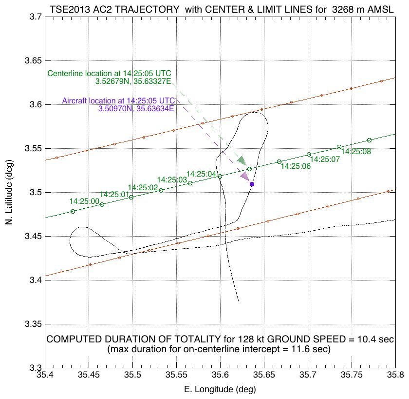
Now, with the images and position data analyzed, we can say the following with respect to what we actually achieved:
The as-observed circumstances of the eclipse from Aircraft #1, as measured from a well-exposed, internally reflected ghost image of the photosphere as recorded on Joel's iphone set (calibrated) to UTC through the Kenyan cell phone network is as follows:
TOTALITY DURATION: 10.73s +/- 0.1s (C2 to C3 complete photospheric extinction)
Contact 2 14:24:58.4 +/- 0.5 s UTC
Mid Eclipse 14:25:03.8 +/- 0.6 s UTC
Contact 3 14:25:09.2 +/- 0.5 s UTC
The location of AC #1 at 14:25:05 UTC was at (or VERY close to): 35d 38.49'E, 03d 31.8'N
The actual "as flown" time-correlated path, from very soon after take-off (once headed westward), as recorded on aircraft 2, has now been overplotted on a graphic animation (corresponding in and around totality to the graph above) of the eclipse at altitude as rendered by Xavier Jubier with his visualization SW from position and other data provided to him. THANKS Xavier! You can SEE THIS HERE (patience while it loads). On the right, in "EFLIGHT" S/W style replicated by Xavier, is an idealized aircraft trajectory for the same intercept that we approached (very differently). This would have been the path we would have executed if we had the luxury of a very longs intercept approach (which we did not) and constant winds (which we did not either). The "important" point is how closely we converged on that idealized intercept at mid eclipse. The ideal case is the long straight blue line that appears a few minutes before totality - note how the as-flown aircraft trajectory converges extremely closely to that just before C2 and throughout totality.
A few notes in detail:
(1) The trajectory was computed and time-correlated for Aircraft #1. Aircraft #2 flew to the same way-points, but trailing AC #1 by a very short distance, so the difference AND executed a final path-crossing turn in lock-step 94 seconds before C2. As a result the durations of totality between the two aircraft differed by a only few tenths of a second, and UTC mid-eclipse by < 1 second. Both saw "essentially" the same eclipse phenomenon.
(2) The final flight trajectory was computed for 10,000 AMSL, but on exiting the final turn onto the short totality run, AC #1 was headed for the top of a cloud, so INCREASED altitude (climbed) to 10,800 ft WITHOUT a compensating trajectory correction at that last minute, so we "lost" a few tenths of a second of totality compared to the fully optimized case (within my pre-set error tolerance goal of +/- 1 second).
"MOVIES!"
The wide-field image of totality shown above, was just one (of 194) frames acquired by Catalin Beldea in a sequence of time-resolved images flanking and during totality. Those images have been assembled into a time lapse animation that plays back in "near" realtime (at 2 fps it actually is 10% of the actual time-average cadence required of 1.78 fps during totality (perhaps corrected in a later release). Both are QuickTime movies. The first at 15% of the original pixel scale to show the entire field of wide-view of the camera. The second cropped to a somewhat narrower (but still wide) field at 40% of the original pixel scale with a smaller region of interest closer to the Sun and shadow on the clouds immediately below.
Note: The COORDINATES given in the movie title frames are for the START of the "straight line" portion of the totality run, NOT for mid-eclipse which is noted above.
DOWNLOAD OR VIEW HERE:
MOVIE #1 -- Widest-Field View
MOVIE #2 -- Cropped Intermediate Field Region
Warning: The sound track affixed to these movies, as recorded and synchronized to the movies, is rated PG 13 (some "strong" language in reaction to an overwhelming eclipse by at least one eclipse viewer on board).
And then we have a hand-held wide-field video (with audio) all from aircraft #1 that is not very "good" as far as eclipse imaging goes, but with the audio does capture the excitement of the moment.
VIDEO #1 (Joel Moskowitz iPhone)
Return to Glenn Schneider's Home Page